AF1T / W4DEX 10 GHz Rain Scatter Contact
21 August 2005 @ 2015 UTC
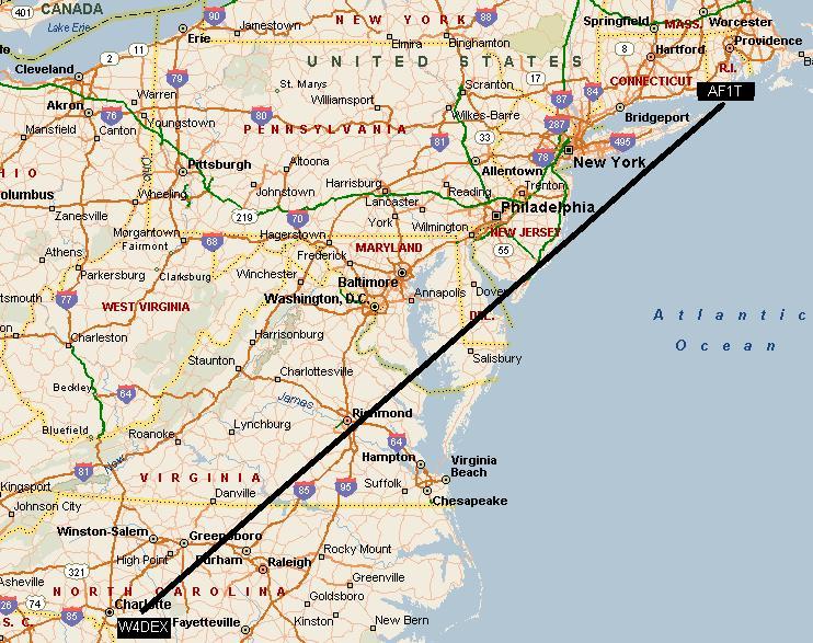
1008 KM / 626 Miles
A contact was made on 10 GHz between Dale, AF1T, operating
portable from Block Island, Rhode Island and Dex, W4DEX located in North
Carolina during the first weekend of the ARRL 10
GHz contest on Sunday, 21 August 2005. A few small storms started
building in eastern Virginia and North Carolina by mid afternoon. After
making only five 10GHz contacts on Saturday I was thrilled to work Russ, K2TXB
via rain scatter off a small cell located between Richmond and Norfolk,
Virginia. Russ and I have made this path via rain scatter several times
and also via tropo. After our contact, Russ advised me that Dale, AF1T,
would like to give it a try. After entering Dale's location into K0SM's
rain scatter program I told Russ that Dale was way out of range, especially for
this storm. But as always I willing to try so I ran a long series of CQs
which was also heard my Roger, W3SZ.
(Click for 148kb
.wav file of my signal received by W3SZ, Reading, PA) When Russ said Dale was hearing my signal and to give him a call I did and we
easily completed the contact. Dale's signal was about S3 with the
typical rain scatter distortion. I recorded Russ's signal
but due to the excitement I did not think to catch Dale's.
(Click for 79kb .wav of
K2TXB, Vincentown, NJ) (frequency
shift due to tuning, not drift) W1MKY was
operating at the same location as Dale so Russ told me to call her for
another contact. However Mikie was unable to hear my signal. Your
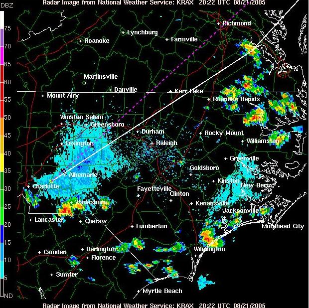
can see how quickly the intensity of the storm changed on the second radar map
below made only 10 minutes after the contact with Dale.
The path distance as calculated by BD2000
using the center to center of the gird method is 1008 KM or 626 miles. The
actual path distance as determined by K2TXB:
From grid EM95tg to grid FN41ee
Distance
= 628.251 mi, 1011.072 km
True
bearing = 46.86°
Reverse
bearing = 232.31°
EM95tg at 35:15:22 - 80:22:48
FN41EE at 41:10:32.8 - 71:35:27
The
distance is 52 Km (32.3 miles) longer than the previous record
Site and equipment information from AF1T:
The site at Block Island, Rhode
Island, is on Beacon Hill, the highest point. We operated from a stone
Observation Tower, built in 1927. It resembles a castle turret and has a 12'
inside diameter. Elevation is about 230 ft. above sea level. Location is in
the Eastern end of FN 41 EE.


Photos by
Ken Tata, K1KT
(Click on picture for full
size view)
The contact was logged at 2015
UTC ( 4:15 EDT ), with cw signals peaking 5-5-9. I had to aim 228 degrees,
even though the direct bearing would be 238 degrees. This gradually shifted
East to 226 degrees. We should have tried SSB and recorded this!
It was definitely Rain Scatter.
AF1T equipment: a DB6NT Transverter
( kit ), driven by a 2-Meter IC-202, with a DL2AM 2-Stage Amplifier, and AF1T
H.B. Pre-amplifier and a 24 inch MA/COM Dish. Output Power is
10-Watts and receiver N.F. measured 1.25 dB.
Site and equipment information for W4DEX:
I was operating from my home QTH in EM95tg.
The 10 GHz transverter was constructed with G3WDG modules by my microwave elmer,
W4OJK (sk) in 1991. (I'm sure Bob was smiling while this contact was being
made.) IF radio is FT-221. RX pre amp is modified Ku LNB.
Power amp is a Hughes1177/H TWT running approximately 15 watts into 3 db
of elipitical waveguide. The antenna is a 2 foot dish obtained from Jeff Kruth a few
years ago. The antenna is located about 105 feet above ground. Click
thumbnail below for large picture.

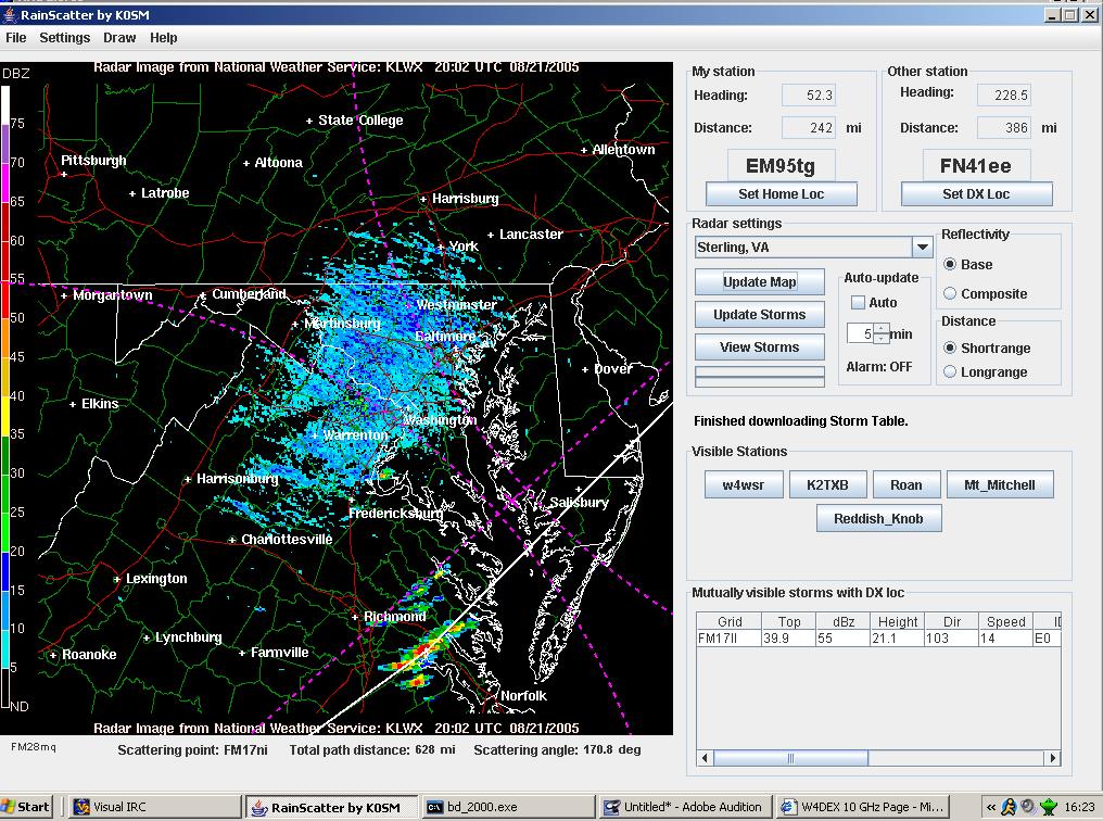
Below is a screen shot of K0SM's rain scatter
program showing the small storm used for this contact. Andy's program has
taken the drudgery out of calculating rain scatter paths. I have spent
many hours calculating paths the hard way so I am expecially greatful for his
effort. This contact most likely would not
have happen without this tool. If you are the slightest bit interested in
microwave rain scatter you will enjoy this program. Find it here:
http://www.frontiernet.net/~aflowers/rainscatter/
Also this contact would not have happen without
liaison from K2TXB. Russ made it possible even though it bumped his NA
rain scatter record set in 1997 while operating W2DRZ.


W4DEX Home Page


